To view, click the link below:
ArcGIS Online Dashboard
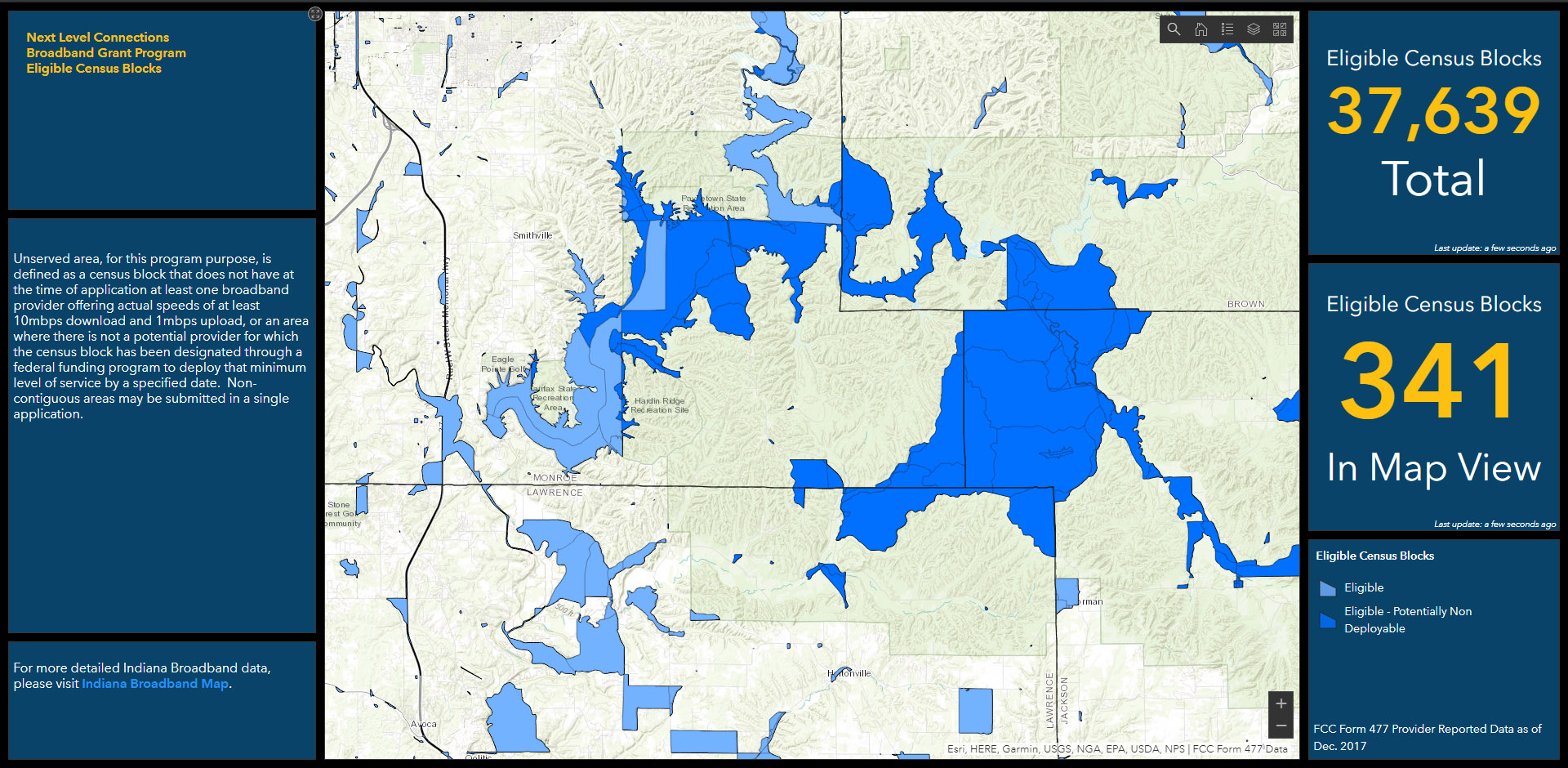
39 DEGREES NORTH was asked to create a dashboard for Indiana’s Next Level Connection Broadband Grant Program. This dashboard displays the eligible census blocks for unserved areas. Unserved area, for this program purpose, is defined as a census block that does not have at the time of application at least one broadband provider offering actual speeds of at least 10mbps download and 1mbps upload, or an area where there is not a potential provider for which the census block has been designated through a federal funding program to deploy that minimum level of service by a specified date. Non-contiguous areas may be submitted in a single application.