![]()
PRESS RELEASE
![]()
News Release July 6th, 2020
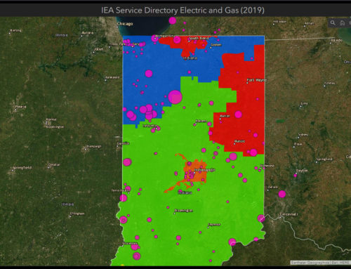
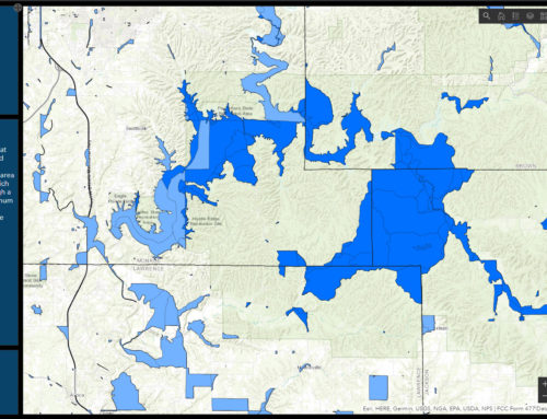
Bloomington, Ind. — 39 Degrees North (39ºN) is excited to announce the acquisition of our Elevate platform and local-government consulting practice to Schneider Geospatial, another leading provider of local e-government services. Elevate provides over 125,000 registered users in 17 Indiana counties with easy internet access to a digital courthouse—a comprehensive suite of local information including property records, tax assessments, zoning regulations, plat maps, and other forms of data. This intuitive system, which delivers more than 800,000 maps on a daily basis, uses geographical layers to help visualize information. Elevate has proved particularly useful during the current health crisis, making it possible for county employees to enter and edit information remotely while allowing users to access the records they need from the comfort of their homes at any time of day.
Headquartered at Fort Benjamin Harrison in Indianapolis, Schneider Geospatial and the Elevate team will be positioned to continue providing local Indiana governments with technologically advanced, cost-efficient, convenient access to information. In joining Schneider Geospatial, Elevate will be integrated into the country’s largest provider of e-government services, with almost 600 local-government clients in 28 states. This expanded foundation will make it possible for Elevate to provide Indiana counties and their residents with many new products and services while continuing to develop innovative solutions and provide local-government clients with the best-in-class customer service they have come to expect.
39ºN started from nothing—a kitchen table for a desk and a single desktop computer purchased with student-loan money—and has since become a leading architect of Geographic Information Systems (GIS) and other cloud-based services. The current Elevate platform is the culmination of 15 years of effort that has undergone 4 major rewrites over the past decade. Elevate has received multiple international achievement awards from Esri. Esri is the world leader in the rapidly expanding industry of geographic information system (GIS) software.
“This agreement will allow the Elevate team and its client base to continue to grow while 39ºN focuses on commercial partners and the state and federal markets. We are grateful for the opportunities we have had to work with our partners in Indiana county government, and we are very proud of the Elevate platform and team,” says Prem Radhakrishnan, the managing member and Co-founder of 39ºN.
In addition to their work on state election-management systems and upgrades to state broadband networks, 39ºN will shift their immediate focus to a facility and asset management project for the Global Deterrence and Defense Department of the Naval Surface Warfare Center at Crane. This project will involve an enterprise implementation of Esri’s new ArcGIS Indoors platform and improve the staff’s ability to visualize and understand their workplace environment and optimize the use of available space.
About 39 Degrees North:
Founded in 2004, geoConvergence, LLC d.b.a. 39 Degrees North is an SBA 8(a)-certified company specializing in Geographical Information Systems, cloud engineering, data analytics, and software development. Our world-class, cloud-based mapping solutions have won Esri’s award for Special Achievement in GIS on three occasions and earned us the recognition of the Indiana Geographic Information Council. The Elevate platform we developed serves over 125,000 registered users and delivers more than 800,000 maps on a daily basis.
About Schneider Geospatial:
Schneider Geospatial, LLC provides creative e-government solutions that change the nature of people’s interactions with government, improving service while lowering costs. Schneider Geospatial is a leader in providing Geographic Information Systems (GIS) solutions to hundreds of municipal, county, state, federal, and private entities. Serving nearly 20% of the counties in the U.S., Schneider Geospatial is one of the largest e-government providers with industry-leading solutions such as Beacon™ / qPublic.net™ (local-government information for the web), GeoPermits™ (cloud-based permitting and workflow management), and Agland™ (automates the process of calculating assessments for agricultural land). Schneider Geospatial is recognized nationally for its award-winning work.